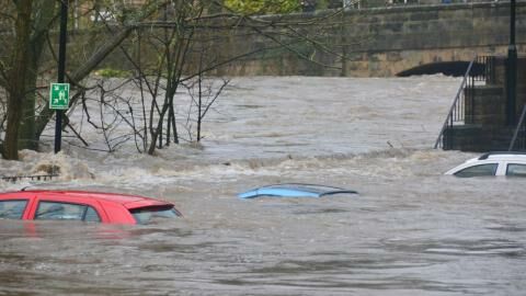
The UK has faced some extreme weather recentlyas Brits have faced everything from sub zero temperatures to gale force winds and flooding. The low temperatures, which triggered the payment of Cold Weather Payments in several parts of the country, have been replaced with heavy rain. A weather warning was released over the weekend and this has now been extended into this week.
Discover our latest podcast
The weather has been the result of two storms, the fifth and the sixth named storms of the season, that have battered the UK with high winds and heavy rain. Storm Elin brought 81 mph winds on Saturday before Storm Fergus swept in on Sunday afternoon with rain, hail and thunder. Here’s how long the weather warnings will remain in place and what we can expect over the next few days.
When will the weather warnings end?
The Met office has yellow weather warnings in place until 3am on Wednesday 13 December. According to Chief Meteorologist Andy Page, Storm Fergus will bring rain this morning:
While the strongest gusts are expected in the Republic of Ireland, Storm Fergus will bring some windy conditions to western areas, including Irish Sea coasts, while also bringing some potentially impactful rain.
The rain has potential to be disruptive in parts of northern England and parts of Scotland, especially where it’s falling on very saturated ground.
Indeed, emergency services were called out in Ireland over the weekend as a possible tornado ripped a roof off a building and left debris covering the streets. The bad weather is now heading towards the UK and, as the Independent points out:
Some 40 flood warnings for England have been issued by the Environment Agency and three by the Scottish Environmental Protection Agency.
What we can expect in the coming days
According to the Met Office’s 5-day forecast, the showers will mostly be concentrated around the north and northwest today. The conditions are likely to worsen overnight with heavy rain and blustery weather, especially in coastal areas, hitting on Tuesday. We might also see some thunderbefore Wednesday brings yet more rain, notably along Scotland’s east coast. From Thursday things should improve, and there will be ‘drier conditions for many on Friday, except the far northwest’.
As Met Office meteorologist Marco Petagna summarised:
After that at the end of the week things will improve, away from north-west Scotland which will be wet, but elsewhere higher pressure will be building, temperatures will be between 8C and 12C, a degree or two above average for this time of the year.
Read more:
⋙ Hidden mould in your house: Here are the signs you should look out for
⋙ UK cold weather: This is why you start feeling aches and pains when temperatures drop
Sources used:
Express: Met Office issues urgent 23-hour rain warning as UK to be battered by giant wall of rain
Independent: Storms Elin and Fergus batter UK as Met Office issues four days of heavy rain warnings


