Google Earth allows archeologists to discover never-seen-before historic sites
Using Google Earth images, archaeologists have discovered the remains of structures dating back to the Bronze Age.
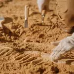
Archaeology isn't just about going to inhospitable places and carefully unearthing artifacts. Of course, it's always necessary to excavate and recover ancient objects, while taking care not to damage them. But the discipline has changed dramatically, thanks to the emergence of new tools such as Google Earth. Indeed, this famous Google feature can help scientists unravel the mysteries of our past.
100 unknown sites discovered via Google Earth
The technology is already there, usable from any device, so why not use it? Launched in 2011, Google Earth is a powerful tool that brings together countless satellite photos to... nothing more, nothing less, reproduce the Earth!
Admittedly, the entire planet is not visible (some military zones are inaccessible, and that's normal), but the tool does allow you to fly over your old apartments, metropolises and countryside, as well as very isolated places.
And it was the latter in particular that interested scientists from University College Dublin. Focusing on Central Europe and the Pannonian Plain in particular, archaeologists have discovered over a hundred previously unknown sites.
Read more: Mysterious 500-year-old ship from the Elizabethan era discovered on English Channel coast
Archaeological sites more easily visible from the air
The sites in question are over 3,600 years old, dating back to the end of the Bronze Age. They are a network of ancient settlement remains stretching over 150 km. According to Arkeonews :
The structures, many of which are being identified for the first time, were hiding in plain sight. Many are invisible from the ground because they have been ploughed almost flat after decades of intensive farming or were destroyed in prehistoric times.
It's not the first time that space imagery has come to the aid of archaeologists. In their study, published in Elsevier, scientists from University College Dublin claim that:
Satellite remote sensing has become an invaluable tool for archaeology, enabling the monitoring of existing sites and the discovery of new ones, as well as the study of their environment.
Read more: Mysterious prehistoric stone circle discovered in the UK (Video)
This article has been translated from Gentside FR.
Sources used:
Arkeonews: Using Google Earth and aircraft reconnaissance, archaeologists identify unknown sites and Serbia’s hidden Bronze Age megastructures
ScienceDirect: Sentinel-2 imagery analyses for archaeological site detection: an application to Late Bronze Age settlements in Serbian Banat, southern Carpathian Basin